JAPS EXPENDED GREAT EFFORT TO
FIT ISLANDS INTO DEFENSE SCHEME
BEFORE 1922 Apra Harbor Area was defended by six 6" guns, which were removed in accordance with the Washington Naval Treaty. When the Japs invaded Guam on December 10. 1941 there were no fixed defenses and their task force of three cruisers, three destroyoers and a convoy of eight merchant ships was able to take possession of the island on the same day. Air coverage was supplied from nearby Saipan and Tinian.
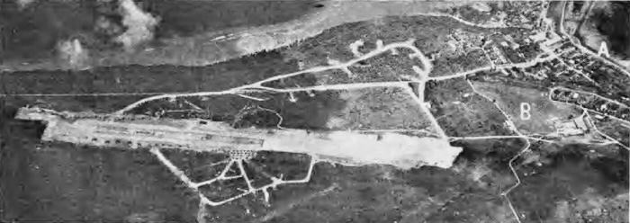
The Japs then proceeded to fit Guam into their scheme of island defenses, and built two major airfields-one in the vicinity of the main town Agana, and the other on Orote Peninsula near Sumay. In the reconnaissance photo of this field shown at the top of the page it can be seen how they related the airfield to the town at "A" and the former U.S. Marine reservation at "B". Note that in spite of plane revetments in the wooded areas adjacent to the field, most of the planes on hand are lined up along the edges of the strip and apron. Most of these planes were destroyed later in the attack on the island.
The capital town of Agana also took a heavy blasting from artillery barrage and pre-invasion sea and air bombardment. The two pictures below show the town as it appeared before the Jap invasion and after the Japs had been conquered. It has been reduced to destruction, Guam came under control of the United States in 1898. After the Spanish-American War, the U.S. took the Philippines and Guam and returned all the other Spanish islands to Spain. In 1899 Spain sold these other islands to Germany, and Germany lost them to the Japanese in World War I.
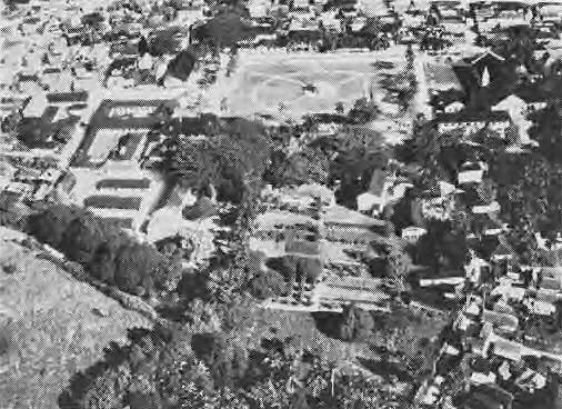 THIS IS the main square in the town of Agana, capital of Guam; federal offices on left, and
church at right. CO Hdqrs. were here.
THIS IS the main square in the town of Agana, capital of Guam; federal offices on left, and
church at right. CO Hdqrs. were here.
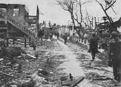 U.S. MARINES walk the streets of Agana after the invasion. A heavy toll was taken of city's
structures by U.S. bombardment.
U.S. MARINES walk the streets of Agana after the invasion. A heavy toll was taken of city's
structures by U.S. bombardment.
AFTER GUAM became a dependent of the U.S.A., President McKinley issued an executive order placing the island under the control of the Navy Department headed by a naval officer appointed by the President. When the island was declared a naval station, American health and public school systems were introduced and more than a hundred miles of highway were built over the island. Autos and jitneys became common, in addition to the native two-wheeled carts drawn by cattle or carabao. The naval government adminstration was handled by departments headed by naval officers holding office during a two-year tour of duty and assisted by trained native clerks with permanent positions in the naval government.
Some of the Pacific's bloodiest fighting took place in the conquest of the Marianas, especially on the island of Saipan, the first of the group to be invaded by American troops. But the capture of these islands marks a great advance and brings U.S. bombers within range of the heart of Japan.