 The word "typhoon" is partially derived from the Chinese expression taai fung or "great
wind." To mariners and inhabitants of the Far East, the word means death and destruction. To military
commanders, charged with conducting safe and effective operations throughout Orient, it represents hazards,
delay and sometimes loss of men and equipment. To meteorologists, a typhoon is a tropical cyclone that
usually develops over the open seas of the Western Pacific, wanders on an erratic course, and then strikes a
land mass with devasting force.
The word "typhoon" is partially derived from the Chinese expression taai fung or "great
wind." To mariners and inhabitants of the Far East, the word means death and destruction. To military
commanders, charged with conducting safe and effective operations throughout Orient, it represents hazards,
delay and sometimes loss of men and equipment. To meteorologists, a typhoon is a tropical cyclone that
usually develops over the open seas of the Western Pacific, wanders on an erratic course, and then strikes a
land mass with devasting force.
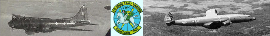
To the officers and men of Airborne Early Warning Squadron One (VW-1), typhoons are dark and unfriendly
"ladies" who must be approached with caution and treated with respect. At present, the only adequate way to
obtain information about these tropical cyclones is to fly specially equipped aircraft through them, and VW-1 is
tasked with the low-level, nighttime reconnaissnace. 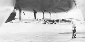
Late in the afternoon, 22 Typhoon Trackers take off from NAS Agana, Guam in their Lockheed WC-121N Constellation and set a course for the storm's forecast position. Earlier in the day the Air Force 54th Weather Reconnaissance Squadron made two daytime penetrations at 10,000 feet or above. Information from these fixes and weather data from other sources, such as satellite pictures, give the Navy crew an idea of the nature of the typhoon.
However, typhoons change rapidly, and Trackers must be prepared for a completely "new" storm each time they make a penetration. The crew make their first penetration - normally below 1,000 feet - in the early evening. Six hours later, they return in darkness, either at the same altitude or at the 700 millibar level (10,000 feet). They find that between the two fixes the storm has twisted, turned and blown around in all but predictable directions.
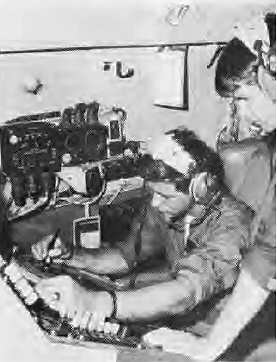
During each penetration, the aircraft commander, copilot and flight engineer have their hands full keeping the aircraft trimmed, level and at optimum altitude. The WC-121N's wings flex, absorbing some of the impact of the turbulence, but it still bounces several hundred feet at a time.
Because the pressure altimeter is misleading inside a typhoon, the pilot depends upon the radio altimeter to keep track of the altitude. As the aircraft nears the center of the storm, the pressure drops rapidly and fluctuates wildly. Because of this, one of the aerographers's mates relays "green worm" readings to the pilot from an SCR-718 radio altimeter.
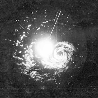
The combat information center officer (CICO) relays the proper heading and keeps the pilot advised of an emergency abort escape heading. He monitors the aircraft's radar track and is in constant contact with the flight meterologists (metros) in an effort to select the best route through the storm. He and his men spot the heavy "feeder bands" spiraling into a "wall cloud" - a towering mass of clouds that forms the eye of the typhoon. They also watch for bright "commas" and heavy echos that may indicate water spouts or thunderstorms inside the eye where scattered low stratus clouds and light winds usually prevail. The crew flies between the feeder bands and through any "holes" in the wall cloud in minimize turbulence while making a penetration.
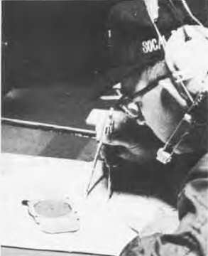
Metro peers down through a bubble window to observe the wind's action against the sea. Because the penetrations are made in darkness, he must sight down the aircraft's landing lights to see the ocean's surface which is often obscurred by low stratus clouds and torrential rains.
By observing the streaking of the wind on the waves, he can judge the intensity and direction of the wind. as the storm develops to gale force (32 to 63 knots), The ocean is covered with white streaks. As the wind increases to greater than typhoon intensity (65 knots), the sea becomes a blanket of seething foam.
 LCdr, Elmer H. Frokjer, and aircraft commander of VW-4 takes a Constellation into the eye of a typhoon.
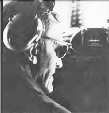
 ATR3 Dennis J. Kron, seated and ATR2 Rex L Gray monitor the storm's progress on radar.
Metro compiles and transmits one of the most important weather messages immediately after penetrating the eye. This message lists the typhoon's position, maximum winds, minimum pressure, highest and lowest temperatures, the shape of the eye and the extent of the feeder bands visible on radar. Metro and his aerographers log this information during penetration.
An accurate "fix" of the typhoon is provided by the navigator. The position is used by the Fleet Weather Central/Joint Typhoon Warning Center (FWC/JTWC) on Guam to predict the future track of the typhoon and to issue approprate storm warnings. The navigator's tools include the aircrafts radar, loran, Doppler system and a great deal of experience.
Sitting across from the navigator in the WC-121N is the radioman. He maintains continuous contact with the appropriate ground radio station. sending out weather messages to FWC/JTWC and handling necessary flight clearances. Through the use of dedicated weather circuits and with the assistance of ground radio personnel (many in the Air Force), the time lapse periods between transmission and receipt at FWC/JTWC are negligible.
The ride into the eye of a typhoon is a challenge in itself. A typical conversation over the internal communication system (ICS) during a penetration might sound like this:
Metro, Pilot. I would like your aerographer to give green worm readings every 30 seconds and on every 50-foot change in altitude.
Pilot, Metro, Roger, Green worm every 30 seconds and 50 feet.
Metro, CICO, What are the winds now?
CICO, Metro, I have 50 knots off the port wing at this time.
Roger, 50 knots.
Green worm, one thousand.
Roger, green worm.
CICO, Metro, How far are we from that feeder band on the radar?
Metro, CICO, We're heading through an opening in the feeder band about 5 miles off and towards a hole in the wall cloud 19 miles off.
Roger CICO, My contact with the surface is getting worse. I have approximately 60 knots now. The wind is slightly behind the wing. Recommend we come port 20 degress whenever possible.
Metro, CICO, Roger, I understand, port 20 degrees when possible.
Green worm, nine hundred.
Roger, green worm.
CICO Pilot, We just had some lightning at two o'clock.
Pilot, CICO We're cutting through a feeder band now. Come port to two eight zero degrees. Your escape heading is one zero zero, We are 15 miles from the wall cloud.
Roger CICO, Port two eight zero, Escape one zero zero, Fifteen out.
For a minute the only sound is the occasional green worm reading over the ICS, puncturing the throb of the engines. The aircraft rapidly drops 200 feet as it cuts through the feeder band but continues to bounce in moderate turbulence. Only one crewman is not strapped down - an aerographer who must move from instrument to instrument during the penetration.
The cabin is dark except for the swivel lamps shining on the metro's table, the green glow of the radar repeaters and the bright lights on the navigators table.
Green worm, seven fifty.
Roger, green worm.
CICO, Metro, I have a hundred knots off the wing. I have contact with the surface ten percent of the time.
Green worm, eight hundred, Green worm, six hundred. Green worm five hundred. Green worm, steady at five hundred.
A high pitched squeal whines through the ICS and then cuts off shortly after the turbulence ceases. (While bending over to look at an instrument, an aerographer knocked his headset off, causing the squeal.) A few loose pencils and temperature calculators fall to the floor. One of the overhead parachutes drops from its straps.
Roger, green worm.
CICO, Metro, The wind is less than 30 knots. We had 100 knots in the wall cloud and a minimum seal level pressure of 961 millibars.
Nav, Metro, Request a fix.
All hands, Pilot. Report any damge or injuries.
Pilot, CICO. I believe the 2nd aerographer bruised his pride. No injuries. One parachute fell from the overhead rack. Radar is in good shape.
While the radar watches assure that the aircraft stays within the confines of the wall cloud, the aerographers launch an instrument to measure seawater temperature. After the required data is accumulated, the aircraft flies back out of the eye. Often the crew selects the same route out that was used to enter.
Approximately 100 miles outside the storm, the aircraft is set on a circular track around the storm. The six-hour interval between penetrations serves as the Typhoon Trackers' "underway replenishment" period.
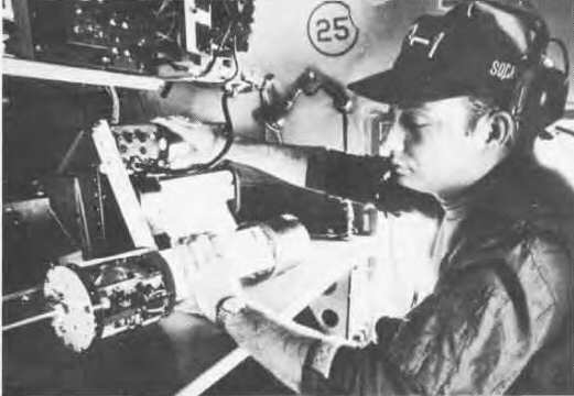
 Lt. S. Ray Palmer, WC-121N navigator, plots course to eye of storm.
 AG2 Alan Zahnie checks calibration of dropsonde weather probe to be used in gathering meteorological data in
the storm.
AG2 Alan Zahnie checks calibration of dropsonde weather probe to be used in gathering meteorological data in
the storm.
Those not involved in monitoring the storm or working at their stations help "fire up" the galley. Relief pilots, navigators, flight engineers, radiomen, radar watches and weather personnel take over while their fellow crew members eat and take catnaps.
The weather equipment in the Typhoon Trackers' Constellation ranges from mercury thermometers to the data acquisition logging system, a computer that collects interprets and transmits weather data from other instruments in the aircraft. The WC-121N contains a full complement of temperature, pressure and humidity sensors, a radar camera and even an infrared sensor that measures the sea surface temperature. In addition, experimental instruments for testing and possible permament use to the aircraft are frequently added to the regular equipment.
Weather data is relayed to FWC/JTWC Guam. There, appropriate information is used for analysis and research and relayed to other research centers, such as the Fleet Numerical Weather Central in Monterey, Calif. Weather observations, dropsonde soundings and other records are sent regularly to the Naval Weather Records Center in Asheville, N.C. In general the data gathered by the squadron's weather reconnaissance flights is a valuable source of meteorological information.
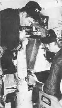 AG2 R. A. Carey and Zahnie, prepare to drop bathothermograph which after plunging into the sea below, will
measure water temperature to a predetermined depth and radio the information back to the aircraft.
AG2 R. A. Carey and Zahnie, prepare to drop bathothermograph which after plunging into the sea below, will
measure water temperature to a predetermined depth and radio the information back to the aircraft.
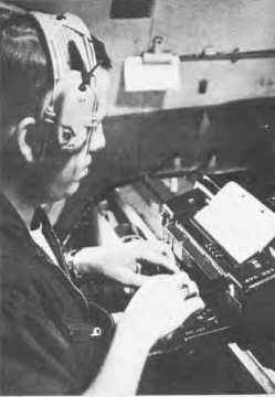 AT1 John MacMahon sends radio report of collected weather data to nearest fleet weather center.
After their night-long flights, crews go back to Guam or an air base near the storm. Very often, a full complement of mechanics will accompany the crews to perform maintenance while the aircraft is away from Guam. In covering their areas of responsibility, from Wake to Vietnam and from the equator to Japan, the Typhoon Trackers fly their ten aircraft about 10,000 hours a year.
Indeed, typhoon tracking is a year round business. In February 1970, Typhoon Nancy whipped up a full 130 knots between Guam and the Phillipine Islands! For that storm, the squadrons crews flew nine low level, night penetrations (five into winds greater than 100 knots) and several other penetrations at 10,000 feet. An average of about 20 full typhoons develop each year, but the majority occur during the summer and fall.
Since VW-1 crews started flying the C-121 in 1953, they have flown over 155,800 hours (as of December 1969) without a single aircraft accident. The Typhoon Trackers were awarded the Chief of Naval Operations Safety Award for 1969.
In addition, while living up to its "early warning" name, the squadron has accumulated many flight hours performing reconnaissance missions for the Seventh Fleet throughout the Far East - its primary mission before it assumed full-time typhoon reconnaissance responsibilities in 1961.
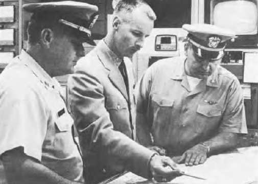 LCdr. Ralph Hanegan, aircraft commander, and Lt. Raymond Hennessey, flight meteorologist, receive briefing on
new tropical storm at PMR Weather Central.
LCdr. Ralph Hanegan, aircraft commander, and Lt. Raymond Hennessey, flight meteorologist, receive briefing on
new tropical storm at PMR Weather Central.
Providing accurate, timely, relevant data is the job of many reconnaissance squadrons. But to fly into the eye of a typhoon in the middle of the night is and unusual and challenging task for any group. In their profession, the officers and men of the Typhoon Trackers are more then an overnight success. They can claim to be one of the best Fly-By-Night organizations.
A detachment of VW-1's Typhoon Trackers is also keeping a weather eye on tropical storms off the West Coast. Operating their WC-121N Constellation from NAS Point Magu, they concentrate their search about 1,200 miles south of Los Angeles where small hurricanes and tropical storms often develop. Though these storms seldom strike heavily populated areas and receive little publicity, they do affect fishing and commercial shipping in the Panama Canal area.
The flights radio meteorological data to the Navy Fleet Weather Center at Alameda, Calif., where appropriate warnings are issued. The crew manning the aircraft are all veterans of at least one typhoon season in West Pac.