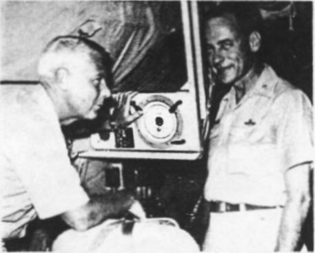
Cooperation, collaboration, and coordination are the bywords of Guam's two weather reconnaissance squadrons. Navy Commander John D. Gibbs, Commanding Officer of Airborne Early Warning Squadron ONE (VW-1), based at NAS Agana, Guam (left), welcomes Air Force Lt. Colonel Robert L. Kane, Commanding Officer of the 54th Weather Roconnaissance Squadron based at Andersen AFB, Guam. The two commanding officers are shown discussing typhoon reconnaissance at VW-1 aboard NAS Agana.
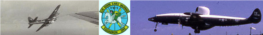
Operating from Guam which is located in the spawning grounds for most typhoons the 54th WRS and VW-1 provide all the airborne location, tracking, and reporting on typhoons in the Pacific.
Once a possible typhoon has been discovered, by any of several different methods, such as a ship or aircraft reports, satellite pictures or island reports, the Joint Typhoon Warning Center on Guam decides whether or not it will be necessary for an aircraft to penetrate the storm in order to determine it's exact position, the severity of the winds, and it's direction of travel. After the decision to penetrate the storm has been made, the Joint Typhoon Warning Center forewards this information to the Tropical Cyclone Reconnaissance Coordinator (TCRC), who in turn levies requirements on each of the Navy and Air Force squadrons. Normally the requirements include pinpointing the storm's center every six hours beginning at 0300 for the life of the storm.
Due to the inherent danger of penetrating a full-blown typhoon during darkness and in view of the extended radar capabilities of the Navy's Lockheed Super Constallation (WC-121N), VW-1 is charged with the responsibility of the locating the storms at night. The 54th WRS flying the radar and weather configured WC-130E Aircraft is likewise charged with the responsibility of maintaining an accurate location of the storms each six hours during the day.
The path of a tropical storm is determined by a number of different factors, but generally can be considered to be the line of least atmospheric resistence. Since this line of least resistence changes continually, though, the storms direction of travel can not be be accurately predicted. So it becomes imperative, because of the devastating winds within typhoons, for their exact location to be known at all times.
The past two months have seen several threats to Okinawa, Iwo Jima and Japan culminating in typhoons Ida and Helen which wrought havoc with Tokyo and the surrounding areas. The tracking and locating of these storms by the 54th WRS and VW-1 again provided much needed warning to the people in their paths.
From the International Date Line to the Bay of Bengal, from the Equator to the Northern Japan Islands, VW-1 and the 54th WRS are known and respected as the Watch Dogs of WestPac.
 Image of original article. Click to enlarge.