The island of Guam sustained catastrophic devastation by Typhoon Karen's passage during the hours of darkness on the 11th and 12th of November. It was equivalent to a "near-miss by a nuclear bomb, less its heat and fall-out contamination." As a result, the President of the United States declared Guam a major disaster area.
Eye passed
Typhoon Karen's eye was eight nautical miles in diameter with seven-NM-thick wall clouds. The center crossed the island from east to west at a speed of 17 knots, entering the coast at about 2000 one-half NM below Talofofo Bay and left the island at about 2030 one NM north of Umatac.
Reinforced concrete structures remained standing; however, the sudden drop in pressure and wind in gusts caused explosive action forcing window panes and louvered casements outward. Subsequent high steady wind and continuous rain associated with this pumping action cleaned out the interiors or caused water damage beyond recovery of interior furniture and effects remaining. Military quarters which were wholly or partially air-conditioned sustained greater damage since the acetate covering prevented the adjustment of pressure falls outside when occupants did not break the seal by removing the acetate or opening louvers to the leeward to permit the house to "breath."
Temporary Structures Suffered
Temporary structures, i.e. quonsets, wooden buildings, outdoor movie screens, the majority of civilian homes, etc., suffered damage in proportion to the maximum wind "belts" over the island. Complete destruction of these structures was experienced in the highest winds over central Guam in a seven-NM band under the northern quadrants of Typhoon Karen's wall cloud. Debris, principally sheet metal sections from quonsets and splintered lumber from these former edifices together with coconuts and gravel used with tar for roofing on permanent buildings, became mobile in the high sustained wind. This rendered additional havoc to permanent and temporary and vehicles, as if they had been bombarded with shrapnel or artillery missiles.
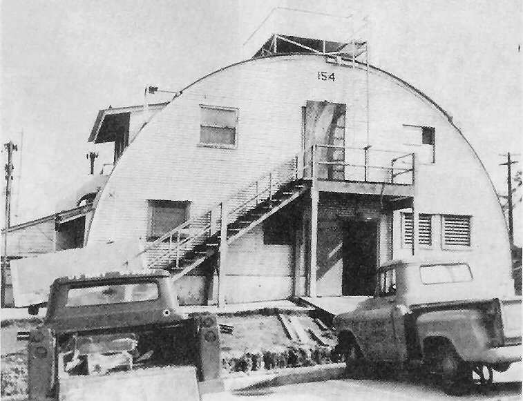 FLEET WEATHER Central/Joint Typhoon Warning Center was the scene of all Typhoon Karen
data reporting until interior damage and loss of roof forced the staff to evacuate.
FLEET WEATHER Central/Joint Typhoon Warning Center was the scene of all Typhoon Karen
data reporting until interior damage and loss of roof forced the staff to evacuate.(ComNavMar Photo)
Analysis of damage patterns in the high wind "belts" confirmed a high frequency of internal tornado-type action as evidenced by isolated temporary housing in the civilian communities suffering minor damage with adjacent houses completely demolished.
Vegetation Damage
Vegetation damage over the island was directly related to the high wind "belts." The northern and southern tips remained green with foliage but the central portion exhibited the eerie appearance of being completely denuded. Snapped and uprooted palm trees and shrubs liken the area to the scorched effects of a forest fire. Bark was stripped off tree trunks and branches as if they had been sandblasted. The stench of decaying vegetation was added to this appalling condition. Utility poles followed the same destructive pattern as the palm trees.
The low loss of life was the extraordinary feature of Typhoon Karen. Her passage during the hours of darkness kept the vast majority of people under cover, meager as is often was. This situation contributed directly to this fantastic safety record of only eight lost, as of November 23, for 76,000 military and civilian inhabitants.
All military personnel and their dependents were quartered in or evacuated to "typhoon-proof" buildings which phenomenally provided enough protection to eliminate any report of death or serious injury.
Warnings
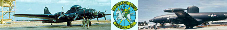
On November 6 the Truk-Ponape area was suspect and the JTWC alerted VW-1 for a November 8 tracking mission. The first JTWC tropical cyclone warning was issued of Tropical Storm Karen at 1800 November 7.
Karen was upgraded to a typhoon at 0600 November 8 based upon analysis of a VW-1 aircraft radar fix and surface reports.
Forcast Track
Starting with the first warning, until Typhoon Karen struck Guam, the forecast track brought the center over the southern Marianas. From the initial warning until 0600 November 10 the forecast track crossed northern Saipan. The typhoon curved sharply toward the west and the forecast track was adjusted southward to the area between Guam and Rota. The 15th JTWC, before land strike on Guam, indicated passage over the northern portion of Guam.
No sharp demarcation line of damage existed from one wind speed band to the next. The area of sustained of 150 knots with gusts to 180 knots occurred underneath or in close proximity to the wall clouds of the typhoon. Maximum destruction occurred in this zone with minimum destruction in the extreme southern tip of Guam with speeds of 60 knots, gusting to 100 knots.
Unique incidents
Members of JTWC formed teams to survey Guam's damage from Typhoon Karen. Many unique incidents were reported by eye witnesses. For example:
Half-Hourly Reports
When Typhoon Karen approached within 200 nautical miles of Guam, two VW-1 radar operators were deployed to the FAA radar site at Mt. Santa Rosa. The half-hourly telephone reports of the bearing and distance of the eye from Guam made by these men proved of inestimable value.
These actions and routine reconnaissance support prepared the population of Guam to receive the passage of the most damaging typhoon of her history.